Comparing Census data from one decade the next can be difficult since boundaries and variables can change. Trying to figure out those differences can be time consuming and sometimes frustrating. To help make this easier, NHGIS recently released 65 time series tables standardizing 2000 & 2010 100% count variables to the 2010 Census boundaries for ten geographic levels including tracts, block groups and 5 digit zip code tabulation areas (ZCTAs).
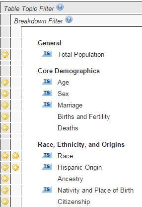
The tables are marked with a TS from within the Topic filter
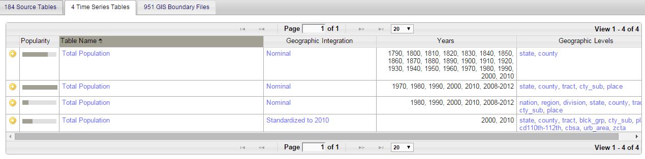
Available standardized tables are listed in the Time Series Tables tab, and labeled Standardized to 2010 under the Geographic Integration column.
More information on time tables produced by the NHGIS can be found in the Data Documentation section, including both the geographically standardized tables as well as nominally integrated tables. The page includes methodology, and a PDF containing the complete list of variables within the time series datasets.